
About Mississippi River Basin Model
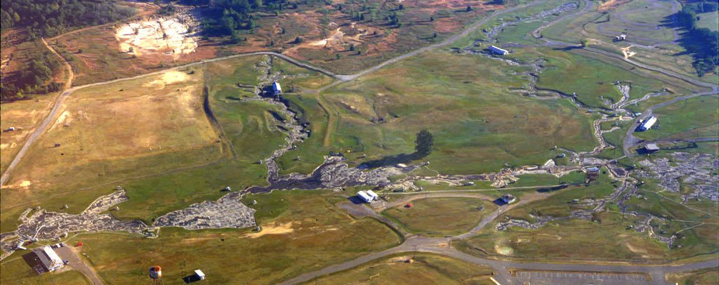
Hidden in Jackson’s Buddy Butts Park is a concrete miniature of an enormous region. The Mississippi River Basin Model spreads across roughly 200 acres and represents about 15,000 miles of rivers and streams. Tiny channels, control gates, and contoured slabs reduced a watershed covering 41 percent of the continental United States to a workable physical system.
The U.S. Army Corps of Engineers began building the model during World War II, using prisoner-of-war labor for early site preparation. Engineers later ran water through the network to study flood behavior and test proposed control plans. Completed in 1966, it became one of the most ambitious hydraulic models ever constructed.
Computers eventually replaced the sprawling facility, and operations ended in the 1970s. The city now owns the site, where volunteers have worked to clear vegetation and preserve surviving sections. Visitors can explore from public park areas for free, but surfaces are uneven and many components are weathered. Even in partial ruin, the model makes continental geography feel strangely tangible.